

お店のコメント(スペック情報を含む場合もあり)
内容説明
Photogrammetry, the use of photography for surveying, is primarily used for the production of maps from aerial photographs. Along with remote sensing, it represents the primary means of generating data for geographic information systems. Photogrammetry has undergone a dramatic evolution in recent years with its transformation into ’digital photogrammetry’. Firstly the distinctions between photogrammetry, remote sensing, geodesy and GIS are fast disappearing, as data can now be carried digitally from the plane to the GIS end-user. And secondly the benefits of digital photogrammetric workstations have increased dramatically. The comprehensive use of digital tools, and the automation of the processes, have significantly cut costs and reduced processing time. The first digital aerial cameras have become available, and the introduction of more and more new digital tools allows the work of operators to be simplified, without the same need for stereoscopic skills.Engineers and technicians in other fields are now able to carry out photogrammetric work without reliance on specialist photogrammetrists. This book shows non-experts what digital photogrammetry is and what the software does, and provides them with sufficient expertise to use it. It also give specialists an overview of these totally digital processes from A to Z. It serves as a textbook for graduate students, young engineers and university lecturers to complement a modern lecture course on photogrammetry. Yves Egels and Michel Kasser have synthesized the contributions of 24 top-ranking specialists in digital photogrammetry, lecturers, researchers, and production engineers, and produced a very up-to-date text and guide.
Book Description
This text, intended for students and professionals looks at photogrammetry - the use of aerial photographs for surveying. It is primarily used for the production of maps from aerial photos. Along with remote sensing, it represents the primary means of generating data for GIS. This book is particularly useful as a text for graduate students in geomatics and is also suitable for people with a good basic scientific knowledge who need to understand photogrammetry, and who wish to use the book as a reference.

お店
アマゾン (amazon)

お店の商品コード
0748409459
JANコード
-
メーカー

商品ジャンル
商品名
最終調査日時
2015/09/27 (Sun) 01:26:38
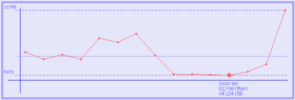
価格の変動(直近3回 : ¥0は未調査回)
取得日時
販売価格
ポイント
実質価格
在庫状態
2015/09/27 (Sun) 01:26:38
¥11,785
0 %
¥11,785
2013/05/04 (Sat) 20:16:14
¥6,170
0 %
¥6,170
2012/06/13 (Wed) 02:50:49
¥5,403
0 %
¥5,403
サイト内キーワード検索
商品名の検索は通常の商品検索ボックスで。
コメントやスペックなどから検索したい場合はこちらから。
コメントやスペックなどから検索したい場合はこちらから。
広告